
Thank you for supporting this site ❤️
Make a donation
Make a donation
Gear up for your next adventure:
As an Amazon Associate, this site earns from qualifying purchases at no extra cost to you.
Cavazzola topographic map
Click on the map to display elevation.
Thank you for supporting this site ❤️
Make a donation
Make a donation
Gear up for your next adventure:
As an Amazon Associate, this site earns from qualifying purchases at no extra cost to you.
About this map
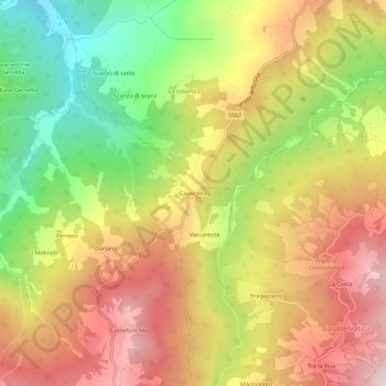
Name: Cavazzola topographic map, elevation, terrain.
Location: Cavazzola, Berceto, Parma, Emilia-Romagna, Italy (44.54348 9.99572 44.58348 10.03572)
Average elevation: 663 m
Minimum elevation: 315 m
Maximum elevation: 984 m
Thank you for supporting this site ❤️
Make a donation
Make a donation
Gear up for your next adventure:
As an Amazon Associate, this site earns from qualifying purchases at no extra cost to you.