
Kentisbeare topographic map
Interactive map
Click on the map to display elevation.
About this map
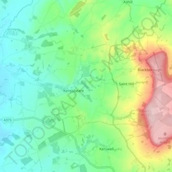
Name: Kentisbeare topographic map, elevation, terrain.
Location: Kentisbeare, Mid Devon, Devon, England, United Kingdom (50.84580 -3.36441 50.88810 -3.27585)
Average elevation: 132 m
Minimum elevation: 56 m
Maximum elevation: 294 m
Devon trails, hiking, mountain biking, running and outdoor activities