
Al Nahdah topographic map
Interactive map
Click on the map to display elevation.
About this map
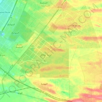
Name: Al Nahdah topographic map, elevation, terrain.
Location: Al Nahdah, Abu Dhabi, Abu Dhabi Emirate, United Arab Emirates (24.23846 54.64782 24.39046 54.76120)
Average elevation: 41 m
Minimum elevation: -6 m
Maximum elevation: 93 m
Other topographic maps
Click on a map to view its topography, its elevation and its terrain.
Abu Al Abyad
United Arab Emirates > Abu Dhabi Emirate > Abu Dhabi > Abu Al Abyad Island
Average elevation: 4 m