
Tubo topographic map
Interactive map
Click on the map to display elevation.
About this map
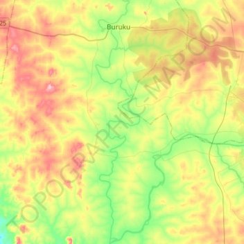
Name: Tubo topographic map, elevation, terrain.
Location: Tubo, Igabi, Kaduna, Nigeria (10.38336 7.20799 10.64666 7.25640)
Average elevation: 604 m
Minimum elevation: 521 m
Maximum elevation: 714 m
Other topographic maps
Click on a map to view its topography, its elevation and its terrain.