Geolocate

Sail topographic map

Click on the map to display elevation.

About this map

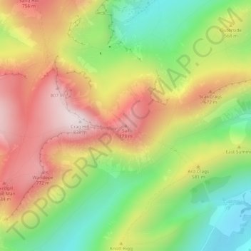
Name: Sail topographic map, elevation, terrain.

Location: Sail, Buttermere, Cumberland, England, CA12 5TW, United Kingdom (54.57130 -3.24173 54.57140 -3.24163)

Average elevation: 513 m

Minimum elevation: 205 m

Maximum elevation: 834 m

Cumberland trails, hiking, mountain biking, running and outdoor activities

Gear up for your next adventure:

🎒Hiking Child Carriers - Explore the outdoors with the whole family safely
🔋Power Banks - Portable chargers for long outdoor trips
🌄Compact Monoculars - Lightweight optics for hiking
🔦Head Torches - Hands-free lighting for hiking and camping
🔋Solar Power Banks - Keep your GPS and phone charged during multi-day expeditions

As an Amazon Associate, this site earns from qualifying purchases at no extra cost to you.