Geolocate

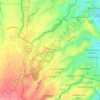
Landayan topographic map

Click on the map to display elevation.

About this map

Name: Landayan topographic map, elevation, terrain.

Location: Landayan, San Pedro, Laguna, Calabarzon, 4023, Philippines (14.34545 121.05903 14.36414 121.07628)

Average elevation: 6 m

Minimum elevation: 0 m

Maximum elevation: 19 m

Other topographic maps

Click on a map to view its topography, its elevation and its terrain.
San Antonio Zone 3

Philippines > Laguna > San Pedro

Average elevation: 77 m

Sitio Maharlika

Philippines > Laguna > San Pedro

Average elevation: 27 m

San Antonio East

Philippines > Laguna > San Pedro

Average elevation: 39 m

San Antonio Zone 3

Philippines > Laguna > San Pedro

Average elevation: 77 m

San Antonio East

Philippines > Laguna > San Pedro

Average elevation: 39 m

Gear up for your next adventure:

🧗Locking Carabiners - Secure gear to your pack or for light technical use
📍Handheld GPS Navigators - Reliable satellite navigation for hiking and off-road exploration
🚶Walking Pedometers - Simple distance tracking for casual trail walkers
🔭Compact Hiking Binoculars - Lightweight optics for scouting terrain and spotting wildlife
👖Packable Overtrousers - Quick-deploy rain protection for legs in sudden storms

As an Amazon Associate, this site earns from qualifying purchases at no extra cost to you.