Geolocate

Doughboy topographic map

Click on the map to display elevation.

About this map

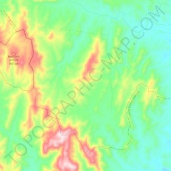
Name: Doughboy topographic map, elevation, terrain.

Location: Doughboy, Bundaberg Region, Queensland, Australia (-25.18683 151.77769 -25.10138 151.89574)

Average elevation: 245 m

Minimum elevation: 69 m

Maximum elevation: 587 m

Other topographic maps

Click on a map to view its topography, its elevation and its terrain.

Gear up for your next adventure:

📦Dry Bags - Waterproof bags to protect gear from rain
🥫Expedition Meals - Lightweight, high-calorie nutrition for long-distance hikers
🧣Neck Gaiters - Protects against wind and sun on exposed ridges and peaks
🧥Waterproof Hiking Jackets - Rain protection for walking in all weather conditions
🧤Hiking Gloves - Warm and durable gloves for cold-weather walks

As an Amazon Associate, this site earns from qualifying purchases at no extra cost to you.