
Barcarrota topographic map
Interactive map
Click on the map to display elevation.
About this map
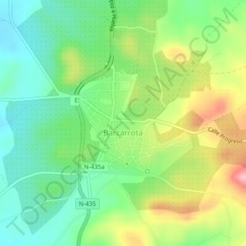
Name: Barcarrota topographic map, elevation, terrain.
Location: Barcarrota, Llanos de Olivenza, Badajoz, Extremadura, España (38.51108 -6.85601 38.52290 -6.83953)
Average elevation: 479 m
Minimum elevation: 422 m
Maximum elevation: 573 m
Other topographic maps
Click on a map to view its topography, its elevation and its terrain.
Barcarrota
España > Extremadura > Barcarrota
Barcarrota, Llanos de Olivenza, Badajoz, Extremadura, España
Average elevation: 475 m