
Rednitzhembach topographic map
Interactive map
Click on the map to display elevation.
About this map
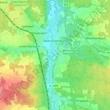
Name: Rednitzhembach topographic map, elevation, terrain.
Location: Rednitzhembach, Roth, Middle Franconia, Bavaria, Germany (49.27175 11.03367 49.31887 11.09622)
Average elevation: 347 m
Minimum elevation: 314 m
Maximum elevation: 396 m