Geolocate

Unterensingen topographic map

Click on the map to display elevation.

About this map
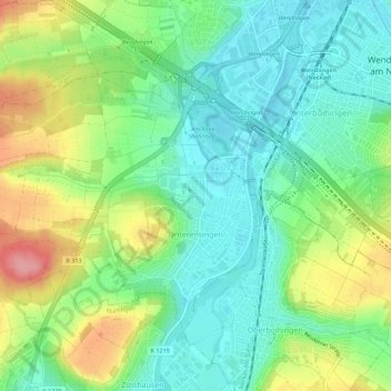
Name: Unterensingen topographic map, elevation, terrain.

Location: Unterensingen, VVG der Stadt Nürtingen, Landkreis Esslingen, Baden-Württemberg, 72669, Germany (48.64751 9.30914 48.67312 9.36541)

Average elevation: 312 m

Minimum elevation: 258 m

Maximum elevation: 396 m

Other topographic maps

Click on a map to view its topography, its elevation and its terrain.
Gear up for your next adventure:

🛌Sleeping Mats - Insulated mats for comfortable outdoor sleeping
📱Rugged Phone Cases - Heavy-duty protection for smartphones used as secondary GPS tools
🧰First Aid Kits - Essential safety kits for outdoor activities
🧥Breathable Waterproof Jackets - Essential rain protection for the unpredictable British climate
🦶Anti-Blister Balms - Protect your feet before long topographic expeditions

As an Amazon Associate, this site earns from qualifying purchases at no extra cost to you.