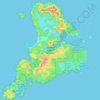
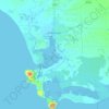
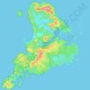
Taoroa topographic map
Click on the map to display elevation.
About this map

Name: Taoroa topographic map, elevation, terrain.
Location: Taoroa, Chatham Islands, New Zealand (-43.77942 -176.75585 -43.75942 -176.73585)
Average elevation: 11 m
Minimum elevation: 0 m
Maximum elevation: 63 m
Other topographic maps
Click on a map to view its topography, its elevation and its terrain.
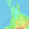

Fiordland National Park
Several large lakes lie wholly or partly within the park's boundaries, notably Lake Te Anau and Lake Manapouri, both on the western boundary of the national park, as well as the southern lakes Lake Monowai, Lake Hauroko, and Lake Poteriteri. All of these lakes exhibit the topography typical of glacier-carved…
Average elevation: 417 m
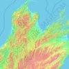
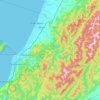

Mount Richmond Forest Park
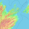
Established in 1977, the forest park is located between Nelson and Marlborough and consists of 1,659 km2 (641 sq mi) of conservation estate. Around 80% of the area is covered in bush. The most notable peak in the forest park is Mount Richmond, which has an elevation above sea level of 1,760 metres (5,770 ft).
Average elevation: 403 m
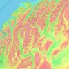
South Island
The South Island (Māori: Te Waipounamu, lit. 'the waters of Greenstone', officially South Island or Te Waipounamu or archaically New Munster) is the largest of the three major islands of New Zealand in surface area, the other being the smaller but more populous North Island and sparsely populated Stewart…
Average elevation: 201 m
Southland
Fiordland has a wet mountain climate though conditions vary due to altitude and exposure. Rainfall is the highest in the country and varies between 6,500 and 7,500 mm annually. The farthest coastal reaches of Fiordland are characterized by a limited temperature range with increasing rainfall at higher…
Average elevation: 229 m
Doubtful Sound
New Zealand > Southland > Southland District > Fiordland Community
Average elevation: 560 m


Manawatū-Whanganui
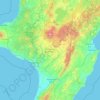
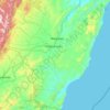
The area includes a variety of landscape formations. Districts close to the Volcanic Plateau are higher and more rugged, often subject to harsh temperatures in winter. The Manawatū District has a much gentler topography, consisting mainly of the flat, tree-studded Manawatū Plains that run between the ranges…
Average elevation: 306 m


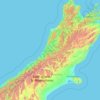
South Island
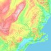
The South Island, also officially named Te Waipounamu, is the larger of the two major islands of New Zealand in surface area, the other being the smaller but more populous North Island. It is bordered to the north by Cook Strait, to the west by the Tasman Sea, and to the south and east by the Pacific Ocean.…
Average elevation: 201 m
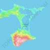
Chatham Island
Much of the area between the bays is taken up by the large Te Whanga Lagoon, which drains to the sea to the east, into the southern half of Hanson Bay. This lagoon covers about 160 square kilometres (62 sq mi), and drains several small rivers that rise in the hills at the south end of the island. The next…
Average elevation: 18 m






Clutha River
The Clutha River drains the high mountains of the Southern Alps in the west and passes through a complex topographic system of basins and ranges towards the east before reaching into the Pacific Ocean. A majority of the topographical features of the Clutha River catchment area are a direct result of the late…
Average elevation: 555 m


Mangawhero River
New Zealand > Manawatu-Whanganui
The source of the Mangawhero River is located on the slopes of Mt Ruapehu at elevation of approximately 1,800 m (5,900 ft). The river begins within the area of the Tūroa skifield and flows down the slopes of the mountain in a south west direction. The Ohakune Mountain Road, built during the 1950s and 60s,…
Average elevation: 460 m


Te Papa-Kura-o-Taranaki
New Zealand > Taranaki > New Plymouth District
The park is located on the west coast of the North Island and is exposed to prevailing winds from the west or northwest. Moist westerlies from the Tasman Sea create orographic precipitation when they reach Mount Taranaki and the adjacent Pouākai and Kaitake ranges. Southerly winds are also common. The…
Average elevation: 500 m
Mount Aspiring National Park
Mount Aspiring National Park covers 3,562 square kilometres (1,375 mi2) at the southern end of the Southern Alps, directly to the west of Lake Wānaka, and is popular for tramping, walking and mountaineering. Mount Aspiring / Tititea, elevation 3,033 metres (9,951 ft) above sea level, gives the park its name.…
Average elevation: 770 m

Westland Tai Poutini National Park
Westland Tai Poutini National Park covers 1,320 square kilometres (510 sq mi) exclusively on the western side of the South Island's main divide, making it New Zealand's fifth largest national park. The park covers a wide variety of environments, ranging from high alpine tundra near the park's border with…
Average elevation: 685 m

Stewart Island
Although the clay soil is not very fertile, the high rainfall and warm weather mean that the island is densely forested throughout. Native plants include the world's southernmost dense forest of podocarps (southern conifers) and hardwoods such as rātā and kāmahi in the lowland areas with mānuka shrubland…
Average elevation: 63 m