

Le Markstein topographic map
Click on the map to display elevation.
Le Markstein
Le Markstein is a winter sports station in the Vosges mountains in France situated at an altitude of between 1,020 m (3,346 ft) and 1,268 m (4,160 ft) which is located on the Route des Crêtes. It forms a set of cross-country skiing with the Breitfirst ski-station and the Grand Ballon. The highest point is the summit of the Jungfraukopf. The station staged World Cup skiing in 1983 and 1987 and World Cup Paragliding in 1999. The roads through the station are also used from time to time by the Tour de France cycle race, including twice in 2014.
About this map
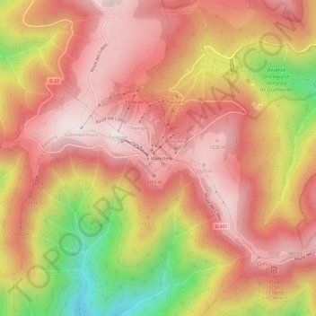
Name: Le Markstein topographic map, elevation, terrain.
Average elevation: 1,013 m
Minimum elevation: 552 m
Maximum elevation: 1,263 m