Geolocate

Segla topographic map

Click on the map to display elevation.

About this map

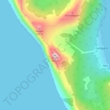
Name: Segla topographic map, elevation, terrain.

Location: Segla, Fjordgård, Senja, Troms, 9388, Norway (69.50732 17.59567 69.50742 17.59577)

Average elevation: 135 m

Minimum elevation: -1 m

Maximum elevation: 643 m

Gear up for your next adventure:

👟Men's Trail Running Shoes - Lightweight grip for fast movement over topographic contours
🚶Walking Pedometers - Simple distance tracking for casual trail walkers
🗺️Ordnance Survey Maps - Official UK maps for walking and outdoor activities
🥫Expedition Meals - Lightweight, high-calorie nutrition for long-distance hikers
🔋Solar Power Banks - Keep your GPS and phone charged during multi-day expeditions

As an Amazon Associate, this site earns from qualifying purchases at no extra cost to you.