
Lake Siena topographic map
Interactive map
Click on the map to display elevation.
About this map
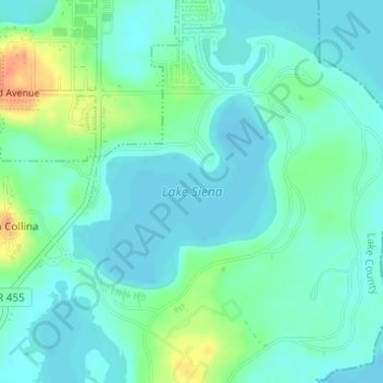
Name: Lake Siena topographic map, elevation, terrain.
Average elevation: 26 m
Minimum elevation: 15 m
Maximum elevation: 58 m
Other topographic maps
Click on a map to view its topography, its elevation and its terrain.
Bella Collina
États-Unis d'Amérique > Floride > Lake County > Bella Collina
Bella Collina, Lake County, Floride, 34756, États-Unis d'Amérique
Average elevation: 30 m