
Thank you for supporting this site ❤️
Make a donation
Make a donation
Gear up for your next adventure:
As an Amazon Associate, this site earns from qualifying purchases at no extra cost to you.
Cireșa topographic map
Click on the map to display elevation.
Thank you for supporting this site ❤️
Make a donation
Make a donation
Gear up for your next adventure:
As an Amazon Associate, this site earns from qualifying purchases at no extra cost to you.
About this map
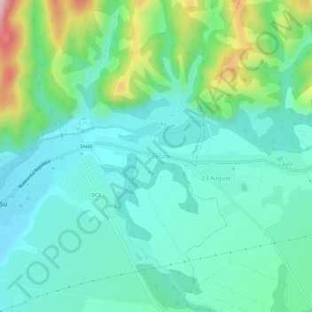
Name: Cireșa topographic map, elevation, terrain.
Location: Cireșa, Oțelu Roșu, Caraș-Severin, 325701, Romania (45.50582 22.36838 45.54582 22.40838)
Average elevation: 333 m
Minimum elevation: 264 m
Maximum elevation: 553 m
Thank you for supporting this site ❤️
Make a donation
Make a donation
Gear up for your next adventure:
As an Amazon Associate, this site earns from qualifying purchases at no extra cost to you.