Geolocate

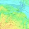
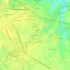
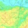
Farmville topographic map

Click on the map to display elevation.

About this map

Name: Farmville topographic map, elevation, terrain.

Location: Farmville, Pitt County, North Carolina, 27828, United States (35.56855 -77.63701 35.61902 -77.55554)

Average elevation: 24 m

Minimum elevation: 11 m

Maximum elevation: 31 m

Other topographic maps

Click on a map to view its topography, its elevation and its terrain.
Staton

United States > North Carolina > Pitt County

Average elevation: 12 m

Twin Creek

United States > North Carolina > Pitt County

Average elevation: 16 m

Stokes

United States > North Carolina > Pitt County

Average elevation: 15 m

Higgs

United States > North Carolina > Pitt County > Greenville

Average elevation: 15 m

Higgs

United States > North Carolina > Pitt County > Greenville

Average elevation: 15 m

Gear up for your next adventure:

⛺Lightweight Solo Tents - Backpacking tents designed for wild camping in the UK highlands
🛑Emergency Bivvy Bags - Heat-reflective survival bags for unexpected nights out
⌚GPS Outdoor Watches - Watches with GPS tracking for hiking and exploration
🧣Neck Gaiters - Protects against wind and sun on exposed ridges and peaks
🗺️Ordnance Survey Maps - Official UK maps for walking and outdoor activities

As an Amazon Associate, this site earns from qualifying purchases at no extra cost to you.