
Thank you for supporting this site ❤️
Make a donation
Make a donation
Gear up for your next adventure:
As an Amazon Associate, this site earns from qualifying purchases at no extra cost to you.
Fuentearmegil topographic map
Click on the map to display elevation.
Thank you for supporting this site ❤️
Make a donation
Make a donation
Gear up for your next adventure:
As an Amazon Associate, this site earns from qualifying purchases at no extra cost to you.
About this map
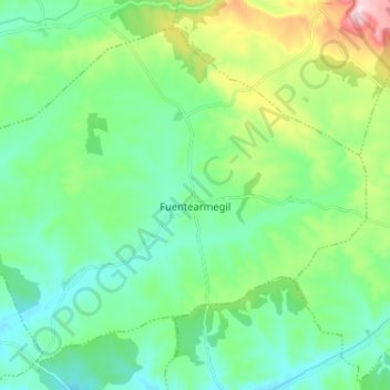
Name: Fuentearmegil topographic map, elevation, terrain.
Location: Fuentearmegil, Soria, Castilla y León, España (41.67552 -3.25516 41.75832 -3.12617)
Average elevation: 999 m
Minimum elevation: 927 m
Maximum elevation: 1,214 m
Thank you for supporting this site ❤️
Make a donation
Make a donation
Gear up for your next adventure:
As an Amazon Associate, this site earns from qualifying purchases at no extra cost to you.