
Make a donation
Gear up for your next adventure:
As an Amazon Associate, this site earns from qualifying purchases at no extra cost to you.
Port Edward topographic map
Click on the map to display elevation.
Make a donation
Gear up for your next adventure:
As an Amazon Associate, this site earns from qualifying purchases at no extra cost to you.
About this map
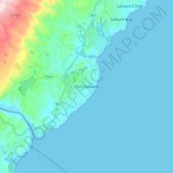
Name: Port Edward topographic map, elevation, terrain.
Average elevation: 42 m
Minimum elevation: -1 m
Maximum elevation: 341 m
Make a donation
Gear up for your next adventure:
As an Amazon Associate, this site earns from qualifying purchases at no extra cost to you.
Other topographic maps
Click on a map to view its topography, its elevation and its terrain.
Umzimkulu River
South Africa > KwaZulu-Natal > Ugu District Municipality > Hibiscus Coast Local Municipality > Port Shepstone
Average elevation: 135 m
Ivy Beach
South Africa > KwaZulu-Natal > Ugu District Municipality > Hibiscus Coast Local Municipality > Leisure Bay > Ivy Beach
Average elevation: 21 m