
Thank you for supporting this site ❤️
Make a donation
Make a donation
Gear up for your next adventure:
As an Amazon Associate, this site earns from qualifying purchases at no extra cost to you.
Naranjillo topographic map
Click on the map to display elevation.
Thank you for supporting this site ❤️
Make a donation
Make a donation
Gear up for your next adventure:
As an Amazon Associate, this site earns from qualifying purchases at no extra cost to you.
About this map
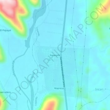
Name: Naranjillo topographic map, elevation, terrain.
Location: Naranjillo, Luyando, Leoncio Prado, Huánuco, Perú (-9.26954 -76.01368 -9.22954 -75.97368)
Average elevation: 664 m
Minimum elevation: 614 m
Maximum elevation: 1,003 m
Thank you for supporting this site ❤️
Make a donation
Make a donation
Gear up for your next adventure:
As an Amazon Associate, this site earns from qualifying purchases at no extra cost to you.