Geolocate

Hawkley topographic map

Click on the map to display elevation.

About this map

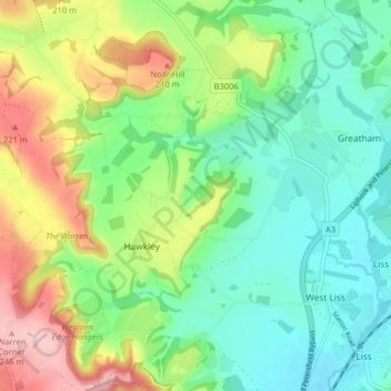
Name: Hawkley topographic map, elevation, terrain.

Location: Hawkley, East Hampshire, Hampshire, England, United Kingdom (51.03797 -0.95693 51.08867 -0.90052)

Average elevation: 125 m

Minimum elevation: 59 m

Maximum elevation: 253 m

Hampshire trails, hiking, mountain biking, running and outdoor activities

Gear up for your next adventure:

🚲Cycling GPS Computers - Track elevation and topographic routes on two wheels
🧣Fleece Neck Warmers - Extra insulation for winter topographic surveys
🎒Backpack Rain Covers - Universal waterproof covers to protect your gear from downpours
🪓Outdoor Multitools - Versatile tools for hiking and camping
🥤Hiking Water Bottles - Reusable bottles for hydration on the trail

As an Amazon Associate, this site earns from qualifying purchases at no extra cost to you.