
Bulawayo topographic map
Interactive map
Click on the map to display elevation.
Bulawayo
Bulawayo experiences water shortages in drought seasons due to the overwhelming increase in population versus the static and sometimes decreasing capacity of the reserve dams. The geographical factors causing water scarcity are rising temperatures, the area's high elevation and the arid environment of Matabeleland. Bulawayo provides residents with water by using a system of dams, treatment plants, and reservoirs.
About this map
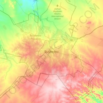
Name: Bulawayo topographic map, elevation, terrain.
Location: Bulawayo, Bulawayo Province, 00000, Zimbabwe (-20.31606 28.42871 -19.99606 28.74871)
Average elevation: 1,348 m
Minimum elevation: 1,210 m
Maximum elevation: 1,479 m