Geolocate

Bulihan topographic map

Click on the map to display elevation.

About this map

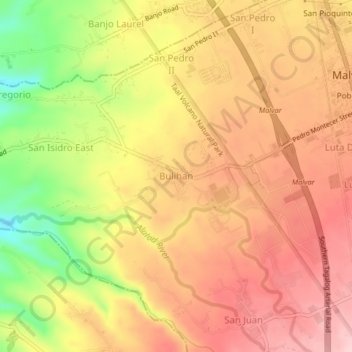
Name: Bulihan topographic map, elevation, terrain.

Location: Bulihan, Malvar, Batangas, Calabarzon, 4233, Philippines (14.01580 121.11728 14.05580 121.15728)

Average elevation: 186 m

Minimum elevation: 58 m

Maximum elevation: 266 m

Other topographic maps

Click on a map to view its topography, its elevation and its terrain.

San Andres

Philippines > Batangas > Malvar

Average elevation: 283 m

Gear up for your next adventure:

👖Packable Overtrousers - Quick-deploy rain protection for legs in sudden storms
🗺️Scratch-off Peak Maps - Track your progress climbing Munros or Wainwrights
🧣Neck Gaiters - Versatile protection against wind and cold
👟Women's Trail Running Shoes - Agile footwear for fell running and technical trails
🐕Hiking Dog Harnesses - Rugged harnesses for taking your companion on mountain trails

As an Amazon Associate, this site earns from qualifying purchases at no extra cost to you.