
Agramunt topographic map
Interactive map
Click on the map to display elevation.
About this map
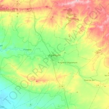
Name: Agramunt topographic map, elevation, terrain.
Location: Agramunt, Urgel, Lérida, Catalogne, 25310, Espagne (41.71699 0.98429 41.85959 1.15265)
Average elevation: 377 m
Minimum elevation: 261 m
Maximum elevation: 545 m
Other topographic maps
Click on a map to view its topography, its elevation and its terrain.