
Canal de Jonage topographic map
Interactive map
Click on the map to display elevation.
About this map
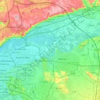
Name: Canal de Jonage topographic map, elevation, terrain.
Average elevation: 215 m
Minimum elevation: 165 m
Maximum elevation: 328 m
Other topographic maps
Click on a map to view its topography, its elevation and its terrain.
Lac de la Forestière
France > Auvergne-Rhône-Alpes > Métropole de Lyon > Meyzieu
Lac de la Forestière, Meyzieu, Lyon, Métropole de Lyon, Rhône, Auvergne-Rhône-Alpes, France métropolitaine, 01120, France
Average elevation: 179 m