
Egmond-Binnen topographic map
Interactive map
Click on the map to display elevation.
About this map
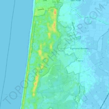
Name: Egmond-Binnen topographic map, elevation, terrain.
Location: Egmond-Binnen, Bergen (NH), Hollande-Septentrionale, Pays-Bas (52.57370 4.59407 52.61504 4.68048)
Average elevation: 4 m
Minimum elevation: -3 m
Maximum elevation: 31 m
Other topographic maps
Click on a map to view its topography, its elevation and its terrain.
Schoorl
Pays-Bas > Hollande-Septentrionale > Bergen (NH)
Schoorl, Bergen (NH), Hollande-Septentrionale, Pays-Bas
Average elevation: 3 m
Bergen (NH)
Pays-Bas > Hollande-Septentrionale > Bergen (NH)
Bergen (NH), Hollande-Septentrionale, Pays-Bas
Average elevation: 4 m