
Pleiskirchen topographic map
Interactive map
Click on the map to display elevation.
About this map
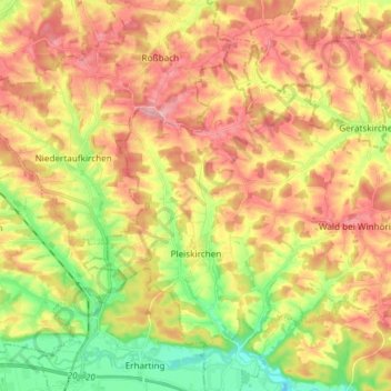
Name: Pleiskirchen topographic map, elevation, terrain.
Location: Pleiskirchen, Landkreis Altötting, Bayern, 84568, Deutschland (48.28211 12.55354 48.35843 12.70233)
Average elevation: 455 m
Minimum elevation: 380 m
Maximum elevation: 522 m
Other topographic maps
Click on a map to view its topography, its elevation and its terrain.
Tüßling
Deutschland > Bayern > Landkreis Altötting
Tüßling, Landkreis Altötting, Bayern, 84577, Deutschland
Average elevation: 426 m