Geolocate

Tecpán topographic map

Click on the map to display elevation.

About this map

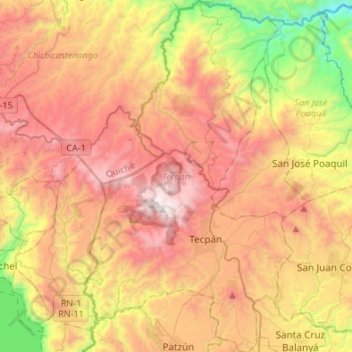
Name: Tecpán topographic map, elevation, terrain.

Location: Tecpán, Chimaltenango, Guatemala (14.67729 -91.08603 14.93850 -90.92502)

Average elevation: 2,158 m

Minimum elevation: 1,190 m

Maximum elevation: 3,063 m

Other topographic maps

Click on a map to view its topography, its elevation and its terrain.

Yepocapa

Guatemala > Chimaltenango > Yepocapa

Average elevation: 1,457 m

Gear up for your next adventure:

🥄Titanium Camping Sporks - The ultimate lightweight utensil for trail meals
🧺Mesh Stuff Sacks - Breathable storage for wet gear or camp organization
Camping Shelters - Emergency and lightweight shelters for outdoor use
🧦Hiking Socks - Breathable socks designed to prevent blisters on long walks
📦Compression Sacks - Reduce backpack volume efficiently

As an Amazon Associate, this site earns from qualifying purchases at no extra cost to you.