
Huétor Tájar topographic map
Interactive map
Click on the map to display elevation.
About this map
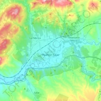
Name: Huétor Tájar topographic map, elevation, terrain.
Average elevation: 590 m
Minimum elevation: 463 m
Maximum elevation: 928 m
Other topographic maps
Click on a map to view its topography, its elevation and its terrain.
Moclín
Spanje > Andalusië > Comarca de Loja
Moclín, Comarca de Loja, Granada, Andalusië, Spanje
Average elevation: 879 m