
A Puga topographic map
Interactive map
Click on the map to display elevation.
About this map
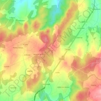
Name: A Puga topographic map, elevation, terrain.
Location: A Puga, Benade, Lugo, Galicien, 27191, Spanien (43.05088 -7.52262 43.09088 -7.48262)
Average elevation: 500 m
Minimum elevation: 432 m
Maximum elevation: 553 m
Other topographic maps
Click on a map to view its topography, its elevation and its terrain.