
Estella-Lizarra topographic map
Interactive map
Click on the map to display elevation.
About this map
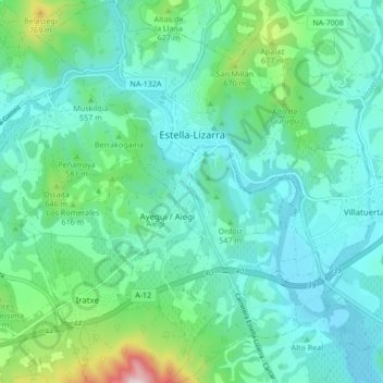
Name: Estella-Lizarra topographic map, elevation, terrain.
Location: Estella-Lizarra, Estellerria / Tierra Estella, 31200, Spain (42.63164 -2.06682 42.69395 -1.99820)
Average elevation: 514 m
Minimum elevation: 398 m
Maximum elevation: 999 m
Other topographic maps
Click on a map to view its topography, its elevation and its terrain.