Geolocate

Hettoli topographic map

Click on the map to display elevation.

About this map

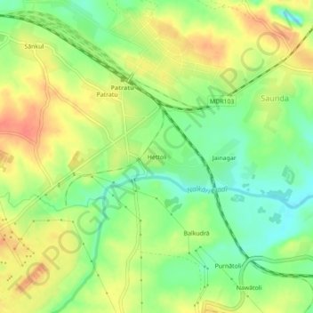
Name: Hettoli topographic map, elevation, terrain.

Location: Hettoli, Patratu, Ramgarh, Jharkhand, 829118, India (23.63701 85.29050 23.67701 85.33050)

Average elevation: 368 m

Minimum elevation: 343 m

Maximum elevation: 392 m

Gear up for your next adventure:

👖Packable Overtrousers - Quick-deploy rain protection for legs in sudden storms
🎿Telescopic Trekking Poles - Reduces knee strain on steep topographic descents
🧣Fleece Neck Warmers - Extra insulation for winter topographic surveys
🦯Walking Poles - Supportive poles for long-distance walking
👕Technical Hiking Tees - Moisture-management for high-exertion climbs

As an Amazon Associate, this site earns from qualifying purchases at no extra cost to you.