
Veren topographic map
Interactive map
Click on the map to display elevation.
About this map
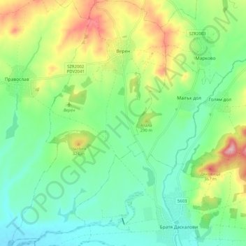
Name: Veren topographic map, elevation, terrain.
Location: Veren, Bratya Daskalovi, Stara Zagora, Bulgaria (42.28988 25.14273 42.36489 25.20760)
Average elevation: 258 m
Minimum elevation: 188 m
Maximum elevation: 403 m
Other topographic maps
Click on a map to view its topography, its elevation and its terrain.
Radnevo
Bulgaria > Stara Zagora > Radnevo
Radnevo, Stara Zagora, 6260, Bulgaria
Average elevation: 128 m