Geolocate

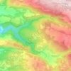
Matat topographic map

Click on the map to display elevation.

Matat

Mattat's name is equivalent in gematria to 840, its altitude in metres. The high location and mountainous region provides the town with a relatively temperate climate. Summer temperatures rarely break 30 °C and humidity is low, and summer nights are even chilly. The winters are cold and wet, with an average of over 800mm precipitation, including the occasional snow.

Wikipedia (CC-BY-SA 3.0)

About this map

Name: Matat topographic map, elevation, terrain.

Location: Matat, Maale Yosef Regional Council, Acre Subdistrict, North District, Israel (33.03764 35.35419 33.04398 35.36106)

Average elevation: 755 m

Minimum elevation: 625 m

Maximum elevation: 999 m

Other topographic maps

Click on a map to view its topography, its elevation and its terrain.
Gear up for your next adventure:

🧥Softshell Jackets - Breathable jackets for active outdoor use
🔋Solar Chargers - Eco-friendly charging solutions for outdoor use
🧊Insulated Flasks - Keeps drinks hot or cold during hikes
👖Convertible Hiking Trousers - Versatile zip-off pants for changing mountain weather conditions
🔥Emergency Fire Starters - Reliable ignition tools for survival situations in damp conditions

As an Amazon Associate, this site earns from qualifying purchases at no extra cost to you.