
Wiesengrund topographic map
Interactive map
Click on the map to display elevation.
About this map
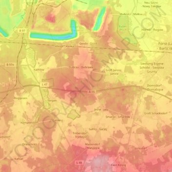
Name: Wiesengrund topographic map, elevation, terrain.
Average elevation: 85 m
Minimum elevation: 12 m
Maximum elevation: 130 m
Other topographic maps
Click on a map to view its topography, its elevation and its terrain.
Mattendorf
Deutschland > Brandenburg > Wiesengrund > Mattendorf
Mattendorf, Wiesengrund, Döbern-Land, Spree-Neiße, Brandenburg, Deutschland
Average elevation: 100 m