
La Gardie topographic map
Interactive map
Click on the map to display elevation.
About this map
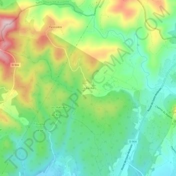
Name: La Gardie topographic map, elevation, terrain.
Average elevation: 312 m
Minimum elevation: 195 m
Maximum elevation: 521 m
Other topographic maps
Click on a map to view its topography, its elevation and its terrain.
Les Boues Rouges
France > Occitanie > Gard > Rousson
Les Boues Rouges, Rousson, Alès, Gard, Occitanie, France métropolitaine, 30340, France
Average elevation: 230 m