
El Buitre topographic map
Interactive map
Click on the map to display elevation.
About this map
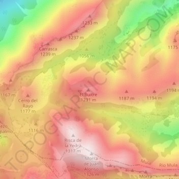
Name: El Buitre topographic map, elevation, terrain.
Location: El Buitre, Mula, Río Mula, Región de Murcia, España (37.89722 -1.55578 37.89732 -1.55568)
Average elevation: 1,096 m
Minimum elevation: 720 m
Maximum elevation: 1,324 m