
Dog Island topographic map
Interactive map
Click on the map to display elevation.
About this map
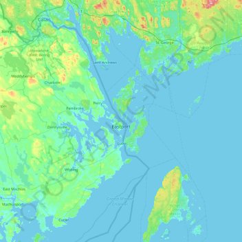
Name: Dog Island topographic map, elevation, terrain.
Location: Dog Island, Eastport, Washington County, Maine, 04631, USA (44.59841 -67.30970 45.23841 -66.66970)
Average elevation: 26 m
Minimum elevation: -2 m
Maximum elevation: 277 m