
Make a donation
Gear up for your next adventure:
As an Amazon Associate, this site earns from qualifying purchases at no extra cost to you.
Kheda topographic map
Click on the map to display elevation.
Make a donation
Gear up for your next adventure:
As an Amazon Associate, this site earns from qualifying purchases at no extra cost to you.
Kheda
Kheda is located at 22°45′N 72°41′E / 22.75°N 72.68°E / 22.75; 72.68. It has an average elevation of 21 metres (68 feet). Kheda is on the banks of Vatrak and Shedhi rivers.
Make a donation
Gear up for your next adventure:
As an Amazon Associate, this site earns from qualifying purchases at no extra cost to you.
About this map
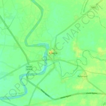
Name: Kheda topographic map, elevation, terrain.
Location: Kheda, Kheda Taluka, Kheda, Gujarat, 387400, India (22.71161 72.64572 22.79161 72.72572)
Average elevation: 27 m
Minimum elevation: 18 m
Maximum elevation: 37 m
Make a donation
Gear up for your next adventure:
As an Amazon Associate, this site earns from qualifying purchases at no extra cost to you.