
Talskiddy topographic map
Interactive map
Click on the map to display elevation.
About this map
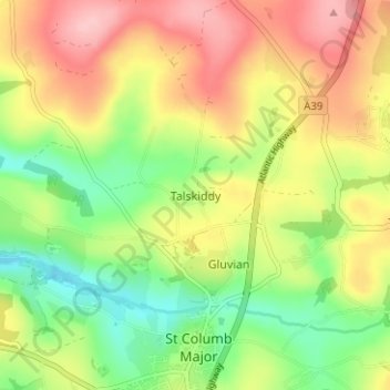
Name: Talskiddy topographic map, elevation, terrain.
Average elevation: 109 m
Minimum elevation: 41 m
Maximum elevation: 183 m
Other topographic maps
Click on a map to view its topography, its elevation and its terrain.
Tremayne
United Kingdom > England > Cornwall > St. Columb Major > Tremayne
Tremayne, St. Columb Major, Cornwall, South West England, England, TR9 6EA, United Kingdom
Average elevation: 121 m