
Charmeil topographic map
Interactive map
Click on the map to display elevation.
About this map
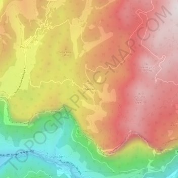
Name: Charmeil topographic map, elevation, terrain.
Average elevation: 877 m
Minimum elevation: 245 m
Maximum elevation: 1,361 m
Other topographic maps
Click on a map to view its topography, its elevation and its terrain.
Le Faz
France > Auvergne-Rhône-Alpes > Isère > Presles
Le Faz, Presles, Grenoble, Isère, Auvergne-Rhône-Alpes, Metropolitan France, 38680, France
Average elevation: 1,022 m