
Bivio topographic map
Interactive map
Click on the map to display elevation.
About this map
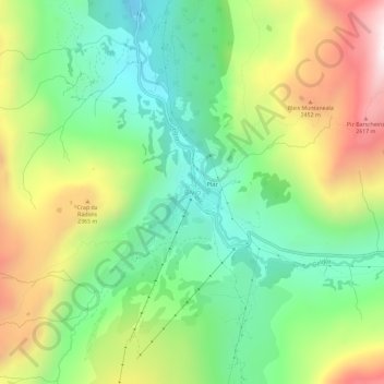
Name: Bivio topographic map, elevation, terrain.
Location: Bivio, Surses, Albula, Graubünden, 7457, Zwitserland (46.44875 9.62969 46.48875 9.66969)
Average elevation: 2,085 m
Minimum elevation: 1,670 m
Maximum elevation: 2,754 m
Other topographic maps
Click on a map to view its topography, its elevation and its terrain.
Savognin
Zwitserland > Graubünden > Albula > Surses
Savognin, Surses, Albula, Graubünden, 7460, Zwitserland
Average elevation: 1,461 m