
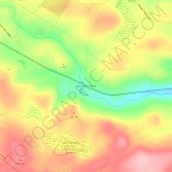
Greenfield Park topographic map
Interactive map
Click on the map to display elevation.
About this map
Name: Greenfield Park topographic map, elevation, terrain.
Average elevation: 331 m
Minimum elevation: 230 m
Maximum elevation: 410 m
Other topographic maps
Click on a map to view its topography, its elevation and its terrain.
Minnewaska State Park Preserve
United States > New York > Ulster County > Town of Wawarsing
Minnewaska State Park Preserve, Town of Wawarsing, Town of Shawangunk, Ulster County, New York, United States
Average elevation: 279 m
Village of Ellenville
United States > New York > Ulster County > Town of Wawarsing
Village of Ellenville, Town of Wawarsing, Ulster County, New York, United States
Average elevation: 325 m
Kerhonkson
United States > New York > Ulster County > Town of Wawarsing
Kerhonkson, Town of Wawarsing, Ulster County, New York, United States
Average elevation: 167 m