Geolocate

Starkville topographic map

Click on the map to display elevation.

About this map

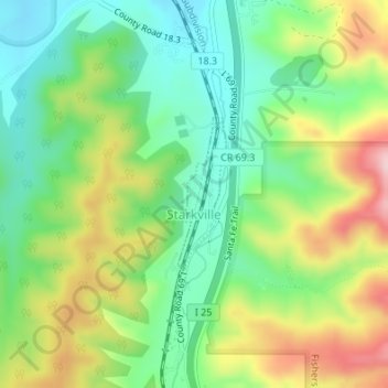
Name: Starkville topographic map, elevation, terrain.

Location: Starkville, Las Animas County, Colorado, United States (37.11133 -104.52559 37.12204 -104.52136)

Average elevation: 1,988 m

Minimum elevation: 1,904 m

Maximum elevation: 2,122 m

Gear up for your next adventure:

🐕Dog Hiking Gear - Equipment for hiking safely with dogs
🔥Emergency Fire Starters - Reliable ignition tools for survival situations in damp conditions
🥤Hydration Bladders - Hands-free hydration systems for backpacks
🧺Ultralight Dry Bags - Organize and waterproof your gear inside your rucksack
📱Phone Mounts for Hiking - Secure mounts to carry your phone on trails

As an Amazon Associate, this site earns from qualifying purchases at no extra cost to you.