
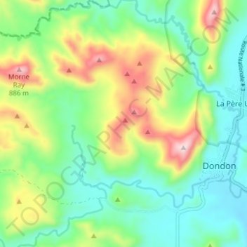
4e Laguille topographic map
Interactive map
Click on the map to display elevation.
About this map
Name: 4e Laguille topographic map, elevation, terrain.
Average elevation: 565 m
Minimum elevation: 402 m
Maximum elevation: 897 m
Other topographic maps
Click on a map to view its topography, its elevation and its terrain.
1re Brostage
Haiti > Département du Nord > Commune Dondon
1re Brostage, Commune Dondon, Arrondissement Saint-Raphaël, Département du Nord, Haiti
Average elevation: 539 m