
Hufenstuhl topographic map
Interactive map
Click on the map to display elevation.
Hufenstuhl
Der Ort liegt auf dem Höhenzug zwischen den Bachtälern der Leneffe und der Agger im nördlichen Teil von Overath an der Grenze zu Lindlar.
About this map
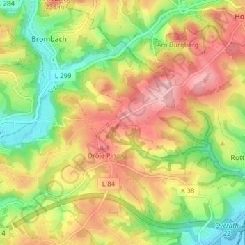
Name: Hufenstuhl topographic map, elevation, terrain.
Average elevation: 178 m
Minimum elevation: 96 m
Maximum elevation: 260 m