
Round Mountain topographic map
Interactive map
Click on the map to display elevation.
About this map
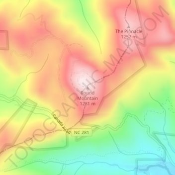
Name: Round Mountain topographic map, elevation, terrain.
Average elevation: 1,075 m
Minimum elevation: 828 m
Maximum elevation: 1,281 m
Other topographic maps
Click on a map to view its topography, its elevation and its terrain.
Dupont State Recreational Forest
United States > North Carolina > Transylvania County
Average elevation: 826 m