Geolocate

Labone topographic map

Click on the map to display elevation.

About this map

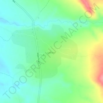
Name: Labone topographic map, elevation, terrain.

Location: Labone, Magwi, Eastern Equatoria, South Sudan (3.79183 32.74577 3.80604 32.76334)

Average elevation: 1,034 m

Minimum elevation: 999 m

Maximum elevation: 1,097 m

Gear up for your next adventure:

🐕Hiking Dog Harnesses - Rugged harnesses for taking your companion on mountain trails
📢Survival Whistles - Essential safety gear for signaling for help in mountain fog
🥤Hydration Bladders - Hands-free hydration systems for backpacks
🥾Trekking Poles - Poles to improve stability on uneven terrain
👕Merino Base Layers - Natural temperature regulation for cold weather hiking and camping

As an Amazon Associate, this site earns from qualifying purchases at no extra cost to you.