
Regional Unit of Evrytania topographic map
Interactive map
Click on the map to display elevation.
About this map
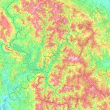
Name: Regional Unit of Evrytania topographic map, elevation, terrain.
Average elevation: 850 m
Minimum elevation: 56 m
Maximum elevation: 2,289 m
Other topographic maps
Click on a map to view its topography, its elevation and its terrain.
Karpenisi
Greece > Thessaly and Central Greece > Regional Unit of Evrytania > Municipal Unit of Karpenisi
Karpenisi, Municipal Unit of Karpenisi, Karpenisi Municipality, Regional Unit of Evrytania, Central Greece, Thessaly and Central Greece, 361 00, Greece
Average elevation: 1,236 m