
Bang Khun Thian District topographic map
Interactive map
Click on the map to display elevation.
About this map
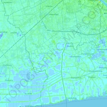
Name: Bang Khun Thian District topographic map, elevation, terrain.
Location: Bang Khun Thian District, Bangkok, 10150, Thailand (13.49073 100.37668 13.68263 100.48164)
Average elevation: 2 m
Minimum elevation: -16 m
Maximum elevation: 15 m
Other topographic maps
Click on a map to view its topography, its elevation and its terrain.