
Ravensden topographic map
Interactive map
Click on the map to display elevation.
About this map
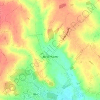
Name: Ravensden topographic map, elevation, terrain.
Location: Ravensden, Bedford, England, United Kingdom (52.16016 -0.47079 52.20105 -0.41807)
Average elevation: 60 m
Minimum elevation: 29 m
Maximum elevation: 85 m
Bedford trails, hiking, mountain biking, running and outdoor activities
Other topographic maps
Click on a map to view its topography, its elevation and its terrain.